Velodyne, Inc. makes sensors that allow self driving cars to navigate
Published in the February 17 – March 1, 2016 issue of Morgan Hill Life
By Lauren Newcomb
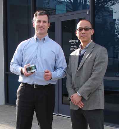
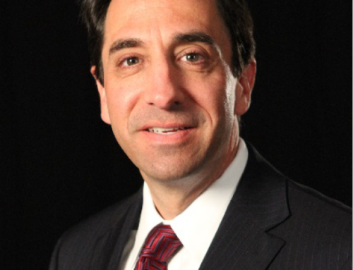
Photo by Lauren Newcomb
Velodyne President Mike Jellen, left, holding Velodyne’s newest LiDAR sensor, and CFO Qing Lu.
We have all heard about self-driving Google cars now being tested around the Bay Area. We all know about Google Maps and street view. But not many of us know that the technology that makes these detailed maps and self-driving capabilities possible comes from a company based here in Morgan Hill.
Velodyne, Inc. in headquartered in an industrial park northeast of downtown. CEO Dave Hall developed the LiDAR sensor a decade ago for the purpose of developing autonomy in vehicles. He succeeded in that purpose. And in doing so, he also discovered many exciting new applications of this remarkable technology – which are paying off big time in the auto world. Velodyne last month received a purchase order from Ford Motor Company for its next-generation advanced driver assistance system (ADAS) LiDAR sensor. Over the years, Velodyne’s LiDAR technology has improved, becoming smaller, lighter, more efficient and less expensive. This allows the cars to move away from the bulky and ostentatious sensors spinning on their roofs and toward hidden sensors on the body of the car.
“We’re pleased to supply industry innovators such as Ford with the most advanced 3D LiDAR sensor in order to improve vehicle safety and transportation convenience as soon as possible,” said Mike Jellen, Velodyne president. “This sensor was developed from Velodyne’s broad customer experience from millions of roadway miles. Only the Velodyne Solid-State Hybrid Ultra Puck Auto will deliver the data quality, form-factor and mass production pricing required for full autonomy and ADAS safety levels 3 and 4.”
LiDAR is a remote sensing technology that measures distance through the use of lasers and analyzing the reflected light as it returns to the sensor. The term LiDAR is both an amalgamation of “light” and “radar” and an acronym of Light Detection and Ranging. LiDAR is mainly used for making detailed, high-resolution maps, like Google Maps, but there are many other applications for the technology in agriculture, robotics, and aerial mapping, among other industrial fields.
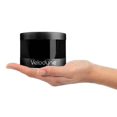
Photo courtesy Velodyne
Velodyne’s newest LiDAR sensor.
LiDAR was originally developed with vehicular autonomy in mind. Laurel Nissen, director of web and marketing communications, explains, “the idea for LiDAR stemmed from the 2004-05 DARPA Grand Challenge that our CEO Dave Hall entered in which he realized that there was a need for an autonomous vehicle to take on the course.” His experience during this challenge led him to develop Velodyne’s first working LiDAR unit, called the HDL-64 Solid-State Hybrid LiDAR sensor. Although it was originally designed for the purpose of vehicular autonomy, the sensor was commercially sold mainly for mapping purposes, such as Google Maps. The spinning cylindrical sensors atop the Google cars are in fact Velodyne’s LiDAR sensors.
Subsequently, Velodyne released the next generation of LiDAR sensors — the lightweight and compact HDL 32E sensor which offered many additional application uses due to its smaller size. No longer limited to automobiles, the LiDAR sensors could be mounted on UAVs (or unmanned aerial vehicles) and used for 3D aerial mapping. The next generation is the VLP-16 LiDAR Puck, which is a 16-channel real-time LiDAR sensor that is quite a bit smaller and much less expensive than previous generation sensors. The VLP-16 received the 2015 North American Automotive Advanced Driver Assistance System Sensors Product Leadership Award.
The most recent LiDAR sensor is the VLP-32 Ultra Puck, which Velodyne announced early January at the Consumer Electronics Show with Ford. Both the VLP-16 and the VLP-32 were created with vehicular autonomy in mind, but are by no means limited to it.
“The technology is used in a variety of commercial applications now,” Nissen said, “including autonomous vehicles, vehicle safety systems, 3D mobile mapping, marine, robotics, 3D aerial mapping and security.”
In agriculture, LiDAR can be used to measure the height of crops to determine how to tend to them. It can also be used to determine whether a swath of land is being overgrazed.
LiDAR sensors create topographical maps of fields that measure sun exposure, slopes, and other relevant data that can then be analyzed in conjunction with data collected from other sources to determine high-yield zones versus low-yield zones. This information helps farmers to decide where to apply the costly fertilizers. LiDAR would also be utilized in the development of a driverless tractor, where GPS signals cannot access them.
Nissen expounded on the future of Velodyne’s LiDAR sensors in the consumer market, stating that Velodyne is currently working with a number of car manufacturers on research and development and more. “We see a big future in automation, not just from a technological standpoint, but from a safety standpoint,” she said.
When asked about what makes LiDAR superior to other methods of mapping, Wayne Seto, product line manager for Velodyne LiDAR, responded that Velodyne’s LiDAR sensors are very sensitive, and can therefore create a highly detailed and precise map, allowing for a much more accurate gradation of color and reflectivity.
“LiDAR provides a more detailed map that allows for a safer and more accurate view of the world,” Seto said. Additionally, LiDAR boasts an accuracy of ±2 cm at large distances, and has a 360 degree range of horizontal motion, providing a view of the world in all directions. This is not only crucial for functional mapping, but also for safety, both in autonomous vehicles and in regular vehicle safety systems.
On Jan. 5, Velodyne announced an order from Ford Motor Company for its new LiDAR sensors. Because the newest sensors have dramatically decreased in weight and size, they can be effectively hidden in side-view mirrors or on the bumpers of cars. This makes the sensors more practical for general consumption, and since Ford is investing more of its resources into autonomous vehicle technology, Velodyne’s LiDAR sensors would be the logical next step in creating such vehicles.
Ford’s interest in the LiDAR technology is not solely limited to vehicular autonomy.
Because LiDAR can map out a vehicle’s surroundings so comprehensively and monitor objects in motion as well as the stationary, the sensors can be used in vehicle safety systems. It is likely that LiDAR will appear in this context for general consumption before self-driving cars hit the streets en masse, but neither seem too far out of the realm of possibility.
Mass production of autonomous vehicles for general consumption is not yet feasible, but, according to Seto, it could be in the near future. “Look at electric cars and hybrids,” Seto remarked.
“They took time to become practical and affordable. It depends on the maturity of the market and the technology. It takes time.”
Considering Velodyne’s track record of making each new generation smaller, lighter, more efficient and less expensive, it may be less time than we think.