Published in the January 17 – 30, 2018 issue of Morgan Hill Life
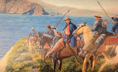
Anza Expedition illustration courtesy Los Angeles State Historic Park
How about we double dip to start the year with a couple of history walks? The Arrowhead Loop trail is becoming one of my favorite South County hikes. It has the perfect blend of distance, elevation, scenic vistas, wildlife and quiet spots. And with the recent rainfall, the hills and meadows should be blanketed with the tender shoots of green grass. For sure, the air and earth will have been refreshed by the rain, causing us to stop just to absorb the sweet, clean scents.
We will meet up with other open space enthusiasts and talk about what was going on in California during the year 1776 while the Declaration of Independence was being drafted.
The Anza Expedition of 1775-1776 was the big historical event in California at that time. We must remember, too, the Native Americans living in California (the Ohlone peoples here) were culturally decimated by the arrival of the Spanish. Juan Bautista de Anza made two journeys into California for the purpose of putting together a colonizing expedition to San Francisco. His first effort was a small military reconnaissance mission that crossed the Sonoran desert and reaching the mission at San Gabriel March 22, 1774. Details of this first trip after leaving San Gabriel are sparse, but Anza and his party did continue north through Santa Barbara, San Luis Obispo and the Salinas Valley to arrive in Monterey April 18, 1774.
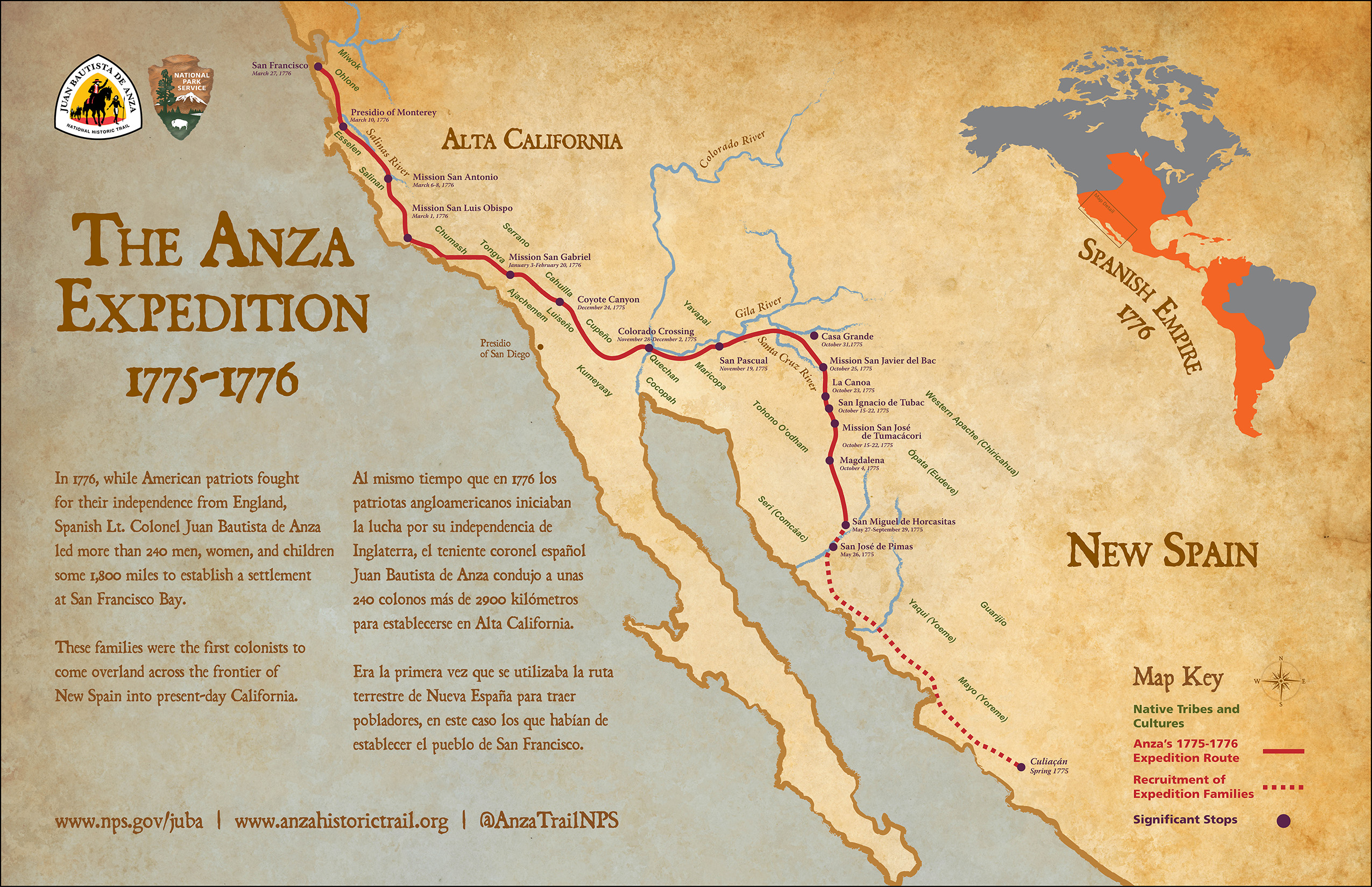
Photo courtesy National Park Service
The objective was to identify an overland route from northern Mexico extending to San Francisco. With the new confidence of a land crossing, Anza was given the responsibility of assembling an expedition of settlers to establish a presidio and mission. He would also locate a site for a future pueblo which would become San Jose in 1777. The company of 240 men, women and children traveled for five months finally arriving in Monterey, March 10, 1776.
The acting governor of California refused to allow the civilians to continue on to San Francisco, but Anza and a small contingent of soldiers and a missionary completed their trek March 28, 1776. Entering the Santa Clara Valley, the Anza party was the first exploratory group to ford the Pajaro River, camping at the Arroyo de las Llagas (where Santa Teresa Boulevard crosses Llagas Creek). Anza and his men continued on the western edge of the valley because an almost impenetrable oak forest fanned out from opening where Coyote Creek spilled into valley floor.
Prior to Anza taking the direct route over the Pajaro River, the 1770 and 1772 expeditions led by the first military governor, Pedro Fages, arrived from Monterey near San Juan Bautista and turned right. Instead of daring the dangerous passage through the Pajaro River drainage, Fages chose an eastern route heading toward Pacheco Pass. These initial forays would hug the eastern foothills and cross the valley following the alignment of Llagas Creek. One could say that the original El Camino Real was not a particular pathway. Rather, it was a wide corridor that changed depending on the time of year. From our vantage points in the hills of Harvey Bear Ranch County Park, we can look over the landscape and make our own conjectures about how much things have changed and will continue to change. I look forward to seeing you on the trail. Keep on sauntering!
Gilroy resident Mike Monroe is a Morgan Hill business owner and naturalist. He is a docent for Santa Clara County Parks.


