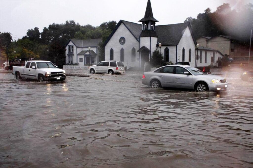
Morgan Hill file photo. Valley Water is asking residents to be prepared for winter storms that are coming.
Valley Water and partner agencies collaborate to prepare for an unpredictable season
By Calvin Nuttall
With winter weather rapidly descending, officials from Valley Water, the National Weather Service and other local agencies gathered to advise the public on flood preparedness at a press conference Nov. 13.
Unlike previous years, where seasonal rainfall has been relatively predictable by observing the large-scale climate patterns called El Nino and La Nina, this year those signals have been “very weak,” said Brian Garcia, Warning Coordination Meteorologist with the National Weather Service.
“The last two winters, it was clear the signal that was out there of when we could expect storms,” Garcia said. “This winter it is more challenging to say when that significant rain is going to come and how much there is going to be.”
After several years of “blockbuster” rainfall, and climate change resulting in increasingly unpredictable weather patterns, officials urged residents and businesses of Santa Clara County to be prepared for anything by readying emergency kits, acquiring sandbags, and keeping up-to-date on weather forecasts by visiting alertthebay.org to sign up to receive emergency alerts.
“In addition to what we do on a yearly basis, we are asking our community members to also take a few easy steps to prepare for storms and the potential for floods,” said Nai Hsueh, Valley Water chair for District 5. “Please ensure you know your flood risk; whether you live in a hot spot, whether you live in a 1-percent floodplain, and that you have downloaded emergency apps and know where to get sandbags before a storm event.”
Hsueh also urged residents to prepare by acquiring flood insurance prior to the arrival of the season’s storms, rather than waiting.
“Whether you own or rent, get flood insurance beforehand,” she said. “Many policies have a 30-day waiting period for the policy to take effect. So, we encourage everyone to beware, be ready, and be flood-safe. Together with Valley Water’s effort, we will be flood-safe.”
Residents can acquire free, pre-filled sandbags at Valley Water’s distribution site in Morgan Hill at the El Toro Fire Station, 18300 Old Monterey Road. To save time, webcams are set up at these sites to allow live monitoring of sandbag availability at a glance. Several other sites in South County offer a place for residents to fill empty sandbags themselves. A list of sandbag distribution sites can be found at valleywater.org/flooding-safety/flood-ready/sandbags. Last year, the agency distributed 140,000 sandbags free of charge.
“Right now, the official forecast is what we call ‘equal chances,’” Garcia said. “The way I like to couch that is it’s the meteorological equivalent of a shrug. We just don’t quite know. That’s why we’re talking about preparedness.”
Officials also urge residents and business owners to prepare for potential flooding by helping to keep avenues for stormwater runoff clear of debris.
“If you’re a property owner, you can keep the curb and gutter next to your property free of debris, including leaves, that can block storm inlets,” said San Jose mayor Matt Mahan. “If you see backed-up storm drains, trees or tree limbs that have been blown down, or any other storm-related hazard in the roadway, please call our dispatch line at (408) 794-1900 or 311.”
Meanwhile, Valley Water and its partners are at work to ensure the county’s stormwater infrastructure is ready for a potentially unpredictable season. The agency manages more than 800 miles of creeks and streams, and works June-October on maintaining these waterways by clearing vegetation, trash, and debris and armoring the waterways against erosion.
While this season may not end up hosting the “blockbuster” storms the region has seen in previous years, even an average amount of rainfall can cause severe flooding if it arrives concentrated in one or two major storms, rather than spread out across the season.
“It boils down to preparation,” Garcia said. “We have to be ready for anything, no matter what I say, no matter what any other meteorologist out there says, if you follow some Twitterologist out there, it doesn’t matter. You’ve got to be prepared for those one or two whopper storms, and then you’ll be prepared for all of them.”
Without the usual hints from the El Nino/La Nina patterns, accurate weather forecasts will be limited to a window of about 7-14 days, provided by the National Oceanic and Atmospheric Administration via its Weather Prediction Center in Maryland.
“Of course, climate change plays a role in that, too,” Garcia said. “It makes it challenging to say how warm the atmosphere is right now, and how much water vapor it can hold, and how much of that water vapor can manifest itself into rain. There are layers to that question, and it makes it more challenging.”
Calvin Nuttall is a Morgan Hill-based freelance reporter.


